Baluarte de Nuestra Señora de la Soledad is one of the most useful places to begin understanding San Francisco de Campeche. From the outside, it is a late-seventeenth-century defensive work beside the old harbour entrance. Inside, the Museo de Arquitectura Maya presents carved stone, architectural elements, stelae, and other objects from Maya sites across Campeche State. The visit connects two histories that are often treated separately: the Spanish fortification of a Gulf port and the much older Maya cities whose remains surround it.
The building is usually shortened to Baluarte de la Soledad, while the museum is called the Museo de Arquitectura Maya or Museo de Arquitectura Maya Baluarte de Nuestra Señora de la Soledad. Both names point to the same compact complex in the historic centre. It is not a substitute for visiting Calakmul or Edzná in their landscapes, but it is an excellent preparation for those sites. It lets you look closely at architectural details that can be difficult to read when they are spread across a large archaeological zone.
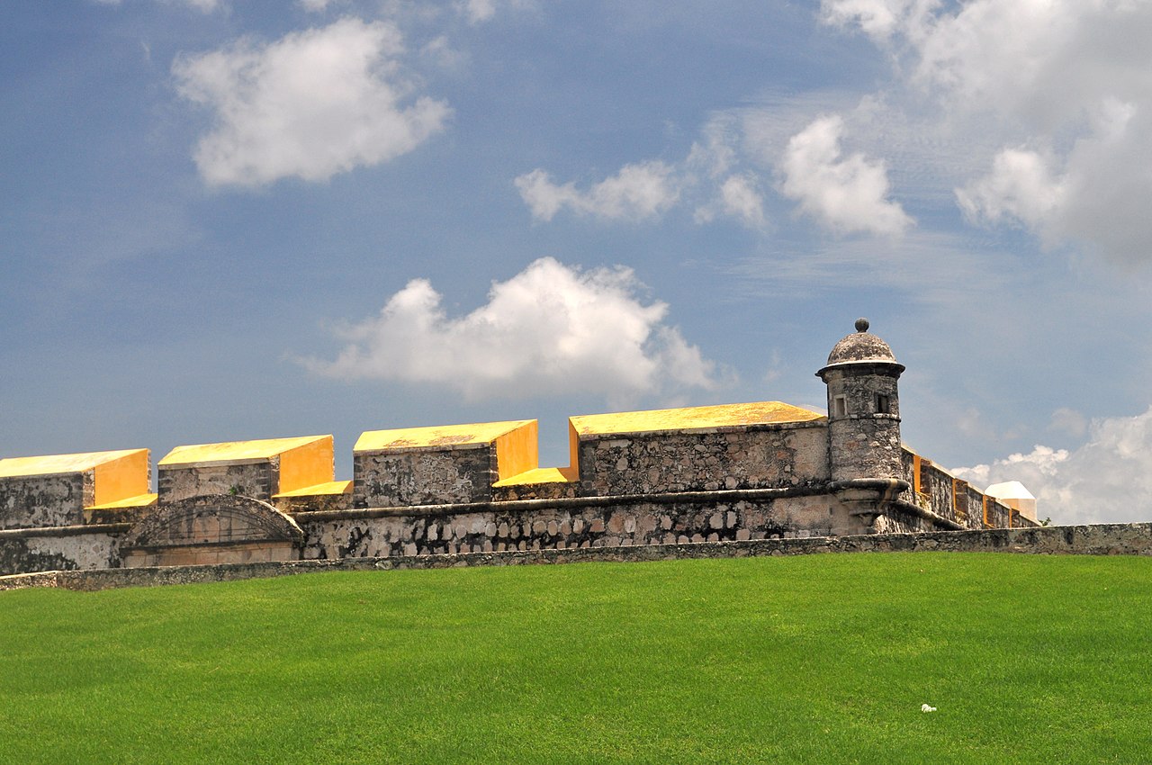 The exterior of Baluarte de la Soledad in Campeche’s historic centre
What Baluarte de la Soledad is
A baluarte is a projecting defensive element in a fortified system. Baluarte de la Soledad formed part of the walls and bastions built to protect Campeche’s colonial settlement and port. Its irregular pentagonal plan and heavy masonry make more sense when seen from the surrounding streets: it projects from the line of the wall, giving defenders a position from which to observe and protect approaches.
The fortification was completed in the late seventeenth century, with construction generally dated to 1690–1692. It was one of the bastions of the larger defensive programme that reshaped the city after repeated attacks on Campeche and other Caribbean ports. The structure was not built as a decorative museum. Its thickness, angles, vaulted rooms, upper level, and relationship with nearby gates reflect a period when the sea was both the source of the city’s wealth and the route by which danger arrived.
Today, the defensive purpose is visible in the form of the building, but the interior serves a cultural purpose. The museum focuses on Maya architecture and sculpture from the present-day state. The result is a layered visit: you move through colonial military space while looking at evidence from Maya communities and political centres that predate the Spanish settlement by many centuries.
The distinction between the bastion and the museum is worth keeping in mind. The bastion is the historic building and part of Campeche’s fortifications. The museum is the exhibition installed within it. If you only photograph the outside, you miss the archaeological collection. If you only read the labels, you miss the military architecture that gives the rooms their unusual character.
Where it is and how to find it
The museum is at Calle 8, between streets 57 and 59, in the Centro Histórico of San Francisco de Campeche. It is inside the walled city, close to the Puerta de Mar and the central Plaza de la Independencia. This is Campeche City in Campeche State, not the Calakmul region in the south and not Ciudad del Carmen on the coast near Laguna de Términos.
The historic centre is compact. If you are already exploring the cathedral, central plaza, Calle 59, or the nearby walls, walking is normally the simplest way to arrive. The museum’s INAH information describes it as being in the first central block of the city and accessible on foot from points within the historic centre. A taxi is sensible if the heat is intense, if you are carrying luggage, or if your accommodation is outside the old city.
Use the Spanish names when asking for directions: Baluarte de la Soledad and Museo de Arquitectura Maya. Maps may display a longer version of the museum name. If a driver knows only the bastion, that is enough; the museum occupies the historic structure.
The building is close to several other attractions, but the streets are not all interchangeable. The Puerta de Mar is the historic gate toward the waterfront side of the walled city. The cathedral faces the main square. Baluarte de la Soledad sits in the same walkable area, but it deserves its own stop rather than being treated as a detail to see from a passing vehicle.
For an overnight base, staying in or near the historic centre reduces the need for repeated short taxi rides and makes it easier to visit the bastion before the streets become hot. Check current Campeche City hotel rates on Booking.com · Compare Campeche City stays on Trip.com
Why the fort was built
Campeche developed as a Spanish colonial port on the Gulf of Mexico, in a region that had long been part of the Maya world. Its location connected the settlement with maritime routes and the movement of timber, agricultural products, people, and official goods. That position made the port valuable, but it also exposed it to attacks by pirates and privateers operating in the Caribbean.
Early defences were not enough for the city’s changing circumstances. The better-known wall and bastion system was developed during the seventeenth and early eighteenth centuries. The walls enclosed the central settlement in an irregular polygon, while bastions projected outward. Additional forts, redoubts, batteries, gates, and other works extended the defensive system beyond the wall itself.
Baluarte de la Soledad was associated with the seaward side of the city and the protection of the harbour approach. Its name refers to Nuestra Señora de la Soledad, the Virgin of Solitude, who was connected with mariners. The building’s position beside the old maritime entrance helps explain why the museum visit pairs naturally with Puerta de Mar and the waterfront rather than with only inland churches and plazas.
The fortifications were not a single event or a perfect ring designed all at once. They were a response to military pressure, engineering requirements, available funds, and the physical shape of the coast. When you walk from one surviving element to another, you are seeing a system assembled over time. Some parts are more monumental; others are embedded in ordinary streets or incorporated into later urban life.
UNESCO inscribed the Historic Fortified Town of Campeche as a World Heritage site in 1999. The designation covers the historic town and its defensive system, not only Baluarte de la Soledad. The value lies in the relationship between the checkerboard street plan, colonial buildings, walls, bastions, gates, and the harbour setting. The museum makes that relationship easier to understand because it places one major defensive structure inside the city rather than presenting it as an isolated ruin.
The building itself
The bastion has an irregular five-sided plan and two levels. Its thick walls and vaulted spaces are more important than ornate decoration. Look at how the rooms are fitted into the mass of the fort, how openings are controlled, and how the upper level relates to the defensive perimeter. The building feels broad and solid from outside, while the exhibition rooms divide the interior into a sequence of more intimate spaces.
The military architecture also explains the changing light. Some rooms are naturally darker than the streets outside, which is useful in Campeche’s heat but can make the transition abrupt. Take a moment at the entrance before moving quickly through the galleries. The contrast between exterior glare, shaded vaults, and illuminated displays is part of the experience of visiting a historic fort.
The upper areas and perimeter offer a different reading of the structure. Where access is open, the edges of the bastion help you see the historic centre in relation to the coast. The view is not the same as the panoramic outlook from Fuerte de San Miguel, which sits on higher ground outside the walled centre. Baluarte de la Soledad gives a lower, more urban perspective: streets, roofs, nearby walls, and the harbour-side direction of the city.
Historic buildings are not uniform in their accessibility. The museum has ground-level rooms and services, but steps, narrow passages, thresholds, and upper areas may affect wheelchair users and people with limited mobility. If you need a step-free route, ask staff at the entrance which rooms and viewpoints are currently accessible. A companion may be helpful in the older parts of the structure.
Do not climb on masonry, lean over edges, or enter a closed passage for a photograph. Restoration and conservation work can change the route without much notice. The fort is both a protected monument and a museum, so the safest path is the one indicated by staff even when another doorway appears open.
What the Museo de Arquitectura Maya displays
The museum’s central idea is architectural diversity within Maya culture. Campeche State contains sites associated with several architectural traditions, including Petén Norte, Río Bec, Chenes, and Puuc. These are not interchangeable decorative styles. They reflect different regional histories, building practices, political relationships, and ways of expressing power in stone and stucco.
The collection includes architectural elements such as columns, jambs, lintels, panels, stelae, and sculpted figures. Some pieces came from sites including Edzná, Xcalumkín, Xculoc, Itzimté, Kankí, and El Palmar. The exact arrangement of rooms and labels can change, but the visitor should look for how each piece once functioned in a building. A lintel was part of a doorway. A jamb framed a passage. A panel carried imagery across a wall. A stela stood in a public or ceremonial context.
This is different from seeing a complete temple from a distance. At an archaeological site, scale and landscape dominate. In the museum, the surface is close enough to inspect. You can follow carved lines, identify breaks, compare stone textures, and notice where a fragment preserves only part of an original scene. The museum should not encourage the idea that an object is simply an isolated sculpture; its purpose is to help you imagine architecture as an integrated setting.
The galleries include material connected with the Puuc, Chenes, Río Bec, and Petén traditions. Visitors who plan to travel south toward Calakmul and the Río Bec sites will find this especially useful. It gives you a vocabulary for noticing doorway treatments, masks, raised platforms, and the relationship between ornament and structure. You do not need to memorise labels. Even one or two comparisons can make the later site visits more legible.
One important group of material comes from Calakmul, including objects associated with the funerary context of Structure VII. Calakmul was a major Maya political centre deep in the tropical forest, and the museum offers a chance to encounter related material without the long drive into the reserve. That convenience has limits: a museum cannot reproduce the sound, humidity, distance, vegetation, and scale of Calakmul. Treat it as context, not replacement.
The museum also highlights a sculpted representation associated with the Señor Pájaro Principal from Chunhuhub and a mascarón linked with K’awiil from Villamar, as well as architectural pieces from other Campeche sites. If a label uses a spelling or transliteration different from a guidebook, follow the museum’s current wording. Maya place names often appear with more than one orthographic form, and a small difference does not necessarily mean a different site.
 Stela 3 from Itzimté displayed at the Museo de Arquitectura Maya Baluarte de la Soledad in Campeche
This museum photograph gives the collection a more concrete focus: the stela is identified as coming from Itzimté, a Campeche site, and is displayed in this same museum. For other archaeological objects, rely on the current labels inside the building rather than assuming that an online photograph represents the whole gallery arrangement. Photography policies can apply to particular objects even when general photography is permitted.
How to read the regional styles
You do not need an archaeology degree to get value from the exhibition. Start with three questions. What is the object’s original architectural job? What kind of surface or doorway might it have belonged to? What does the imagery suggest about authority, ritual, ancestry, or the relationship between a ruler and a wider Maya community?
Petén-related architecture is often discussed through tall monumental forms and strong vertical emphasis. Río Bec sites are known for distinctive towers and elaborate façades, although the actual sites vary and should not be reduced to one visual formula. Chenes architecture is associated with façades that can transform a doorway into the mouth or face of a supernatural being. Puuc architecture uses carefully arranged stonework and geometric or mosaic-like surface treatment, especially in the northern part of the Maya area.
These categories are useful guides, not sealed boxes. Maya cities changed over long periods, exchanged ideas, and used regional practices in different ways. A museum label may identify a style based on archaeological context, architectural features, or comparison with related sites. Do not expect every fragment to display enough information for a confident classification on its own.
The most productive comparison is between fragments from different rooms. Notice whether the stone is plain or heavily carved. Look for repeated geometric motifs. Observe whether a figure appears frontal, profile, human, animal, or supernatural. Pay attention to the scale of the object and imagine the original building around it. A small panel may have been powerful because it was placed at eye level; a large mask may have been designed to dominate a façade from below.
This approach also avoids a common mistake: treating Maya architecture as a generic “ruins” category. Campeche contains many archaeological sites, but they do not all tell the same story or look the same. The museum is valuable precisely because it shows variation within the state.
Current visit information
INAH lists the Museo de Arquitectura Maya, Baluarte de la Soledad as open Tuesday through Sunday from 08:00 to 17:00. The official listing gives the address as Calle 8 s/n, between 57 and 59, in the Centro Histórico. It also lists restrooms, a shop, a library, and parking services. Conditions can change because of public holidays, maintenance, exhibitions, staffing, or conservation work, so verify the current information on the official INAH page before making a special trip.
The same official information lists an admission category for national visitors and residents of Mexico, and a separate rate for foreign visitors. It also notes free admission for certain groups, including children under thirteen, students and teachers with valid credentials, and older adults under the applicable arrangements. Because prices and eligibility rules can change, check the current INAH listing rather than relying on an old travel post or a price remembered from a previous visit.
INAH also states that Sundays are free for Mexican visitors under its usual museum conditions. The museum may be busier on Sundays and around holidays. If you want a quieter visit, a weekday morning is usually a more comfortable choice, subject to the current schedule.
Flash photography, smoking, food, and pets are not permitted according to the published visitor information. Camera rules can be more specific for professional equipment, temporary exhibitions, or individual objects. Carry water for the walk outside, but finish drinks and snacks before entering if staff request it. A small bag is easier to manage in narrow historic rooms than a large backpack.
Plan roughly one to two hours if you want to read labels and look at the fortification, though a quicker visit can work if you are combining several museums. The right duration depends on your interest. Archaeology students, photographers, and travellers preparing for Calakmul may stay longer. Someone fitting the museum between the cathedral and a sunset walk can make a meaningful visit in less time.
Best time of day
Morning is the most reliable choice for heat management. You can visit the museum during its opening period, walk through the quieter central streets, and take a break before the hottest part of the afternoon. The interior provides shade, but the route to and from the bastion is exposed in places.
Late afternoon can work if you want to combine the museum with the waterfront. Leave enough time for the galleries rather than arriving shortly before closing. After the visit, walk toward the Puerta de Mar and continue to the Malecón for the Gulf light. The bastion itself is not the best substitute for a sunset stop; its purpose is history and architecture, while the Malecón provides the broad western view.
Midday is manageable if the museum is your main reason for being in the historic centre, but schedule a shaded pause afterward. Campeche’s heat can be tiring even when distances look short on a map. Carry water, wear breathable clothing, use sun protection, and avoid turning a museum cluster into a rushed march.
Rain changes the experience but does not necessarily ruin it. The galleries can be a sensible shelter during a shower, while stone streets and thresholds may become slippery. During thunderstorms, follow staff instructions and do not linger on exposed upper areas. Check the forecast locally, especially in the wet season.
How to combine it with the walled city
The most coherent route begins with the city’s central plaza and cathedral, continues through the old streets toward Baluarte de la Soledad, and then heads for the Puerta de Mar and waterfront. This order moves from civic and religious space to military architecture, then toward the Gulf setting that explains the fortifications’ importance.
You can reverse the order if the weather is cooler in the morning near the sea. The key is to avoid repeating long crossings. Campeche’s walled centre rewards slow wandering, but the sun makes unnecessary backtracking unpleasant. Look at a map before leaving your accommodation and group the bastion with the other places on the same side of the historic centre.
The cathedral and the museum make a useful contrast. The cathedral shows how religious architecture anchored the colonial city’s public life. The bastion shows how that city was defended. Neither building explains Campeche alone. Together with the walls, gates, domestic streets, and harbour-facing promenade, they reveal a port city shaped by religion, trade, military engineering, and the Gulf.
Calle 59 is a practical connecting street for many visitors, but do not reduce the route to a restaurant corridor. Turn onto side streets and look for changes in paving, colour, doorways, and wall thickness. The most interesting urban details are often between named attractions. Allow time to stop without treating every pause as a formal sightseeing point.
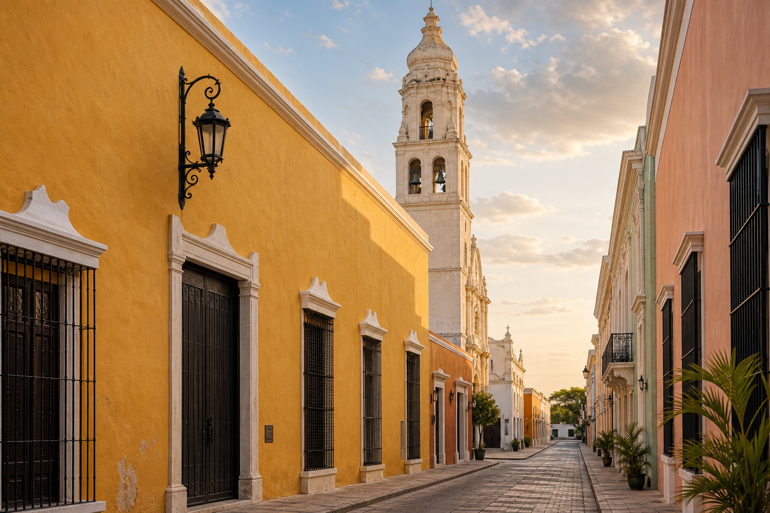
 Plaza de la Independencia and the historic centre of San Francisco de Campeche
Baluarte de la Soledad compared with Fuerte de San Miguel
Travellers with only one museum slot often compare Baluarte de la Soledad with Fuerte de San Miguel. They are not duplicate experiences. Baluarte de la Soledad is inside the walled centre, easy to combine with a walking route, and focused on Maya architecture in a compact historic bastion. Fuerte de San Miguel is a larger defensive work on higher ground outside the centre, with a major archaeological collection and a broader outlook over the city and coast.
Choose the bastion if you are already walking the historic centre, have limited time, or want to understand how Maya architectural fragments fit inside Campeche’s colonial defensive landscape. Choose Fuerte de San Miguel if you want a larger museum experience, more time for archaeology, and views from a hilltop fort. If you have a full day in Campeche, visiting both gives a stronger comparison than treating either as the single “best” museum.
The two sites also create a useful contrast in scale. Baluarte de la Soledad feels embedded in the city’s daily movement. You leave the museum directly into the historic street grid. Fuerte de San Miguel feels more like a destination reached from the centre, and its approach emphasizes the city’s outer defensive geography. Neither should be rushed solely to collect another fortification.
If you use a taxi to reach Fuerte de San Miguel, ask the driver to wait only if you have agreed on the arrangement and cost before leaving. Otherwise, confirm how you will return. For Baluarte de la Soledad, transport planning is simpler because of its central location.
Guided tours and independent visits
An independent visit is straightforward when you are comfortable reading Spanish labels and have already learned the basic history. The museum is compact, and the surrounding fortifications can be explored at your own pace. A guide becomes more useful if you want to connect the bastion with pirate history, colonial urban planning, Maya architectural styles, and the other museums in one continuous explanation.
If you prefer a bookable walking experience, verify the current itinerary and language before reserving. Compare Campeche City tours on GetYourGuide · See historical and heritage tours on Viator. Marketplace listings can change, and a tour that mentions the historic centre may not include museum admission or a long interior visit. Ask what is included rather than assuming the guide’s route covers every room.
A guided tour is most useful when the guide explains relationships rather than reciting dates. Ask about why the bastion was placed where it is, how the walls and gates worked together, which architectural styles are represented in the museum, and how the collection relates to sites such as Edzná, Calakmul, or the Río Bec region. Do not expect a city walking tour to provide a full archaeological lecture; the product description should establish the balance.
Independent travellers can also combine a museum visit with a local guide hired through an official or established channel, but confirm credentials and terms before starting. Avoid pressure to add unrelated shopping stops or activities. The historic centre is walkable without purchasing a tour, so a guide should add interpretation rather than simply provide transport between nearby streets.
Families and younger travellers
The bastion can work well for families because the visit is shorter and more varied than a large open archaeological zone. Children can see walls, vaulted rooms, carved stone, and city views in one place. The museum also provides a break from direct sun. Keep expectations realistic: the collection is not an interactive children’s museum, and labels may be dense or primarily in Spanish.
Give children a simple task. Ask them to find a doorway fragment, a face or mask, a repeated geometric pattern, and a feature of the fort that would have helped defenders. This turns looking into a small investigation without encouraging touching or running. Explain that the stone objects are part of a protected collection and that the bastion itself is an old structure with uneven surfaces.
A stroller may be possible in parts of the route but can be awkward around thresholds, steps, or narrow spaces. A baby carrier is often easier for the historic centre generally, especially if you plan to walk over cobblestones and through gates. Confirm the current accessible route at the entrance rather than assuming that every room is level.
The best family plan is usually one major museum, a shaded meal break, and an outdoor walk later. Trying to visit every fort and museum in one hot afternoon can turn an interesting historic centre into a tiring checklist.
Photography and respectful behaviour
The exterior is easy to photograph from the public streets, but avoid blocking entrances or photographing people at close range without permission. Inside, follow the current signs and staff instructions. Do not use flash where it is prohibited. Professional cameras, tripods, and additional equipment may require permission or a fee.
A museum object is not improved by a flash photograph taken against the rules. Look first, then take a permitted image if allowed. Some fragments are meaningful because of subtle carving that a quick phone photograph will not capture. If you want a record for later study, write down the room or label as well as taking a picture.
At religious or civic sites nearby, behave according to the function of the building. The bastion is a museum, but the cathedral is an active church. The plaza is public, but it is also part of local daily life. Do not treat every resident, ceremony, or street vendor as a backdrop.
What to do after the museum
After leaving Baluarte de la Soledad, walk toward the nearby gate and central streets rather than immediately returning to your hotel. The transition from thick fort walls to colourful façades shows how the defensive perimeter was absorbed into the living city. Look for places where the wall line is obvious and others where it is less visible because streets and buildings have grown around it.
Continue toward the Malecón when the heat and weather allow. Campeche’s waterfront is a promenade, not a guaranteed swimming beach, but it gives the museum’s military history a geographic conclusion. The city’s fortifications faced a Gulf port; the open water makes that relationship easier to feel than a map does.
 The Gulf-front Malecón in San Francisco de Campeche after exploring the historic centre
If you want a longer archaeology day, use the city museum as preparation for Edzná or a later trip toward Calakmul. Edzná is a realistic addition to a Campeche itinerary for travellers who have transport and enough daylight; Calakmul is a much longer commitment and should not be described as a quick extension of a central-city walk. The museum helps with context, but the distances remain real.
For a simple evening, return to the central plaza, sit in a shaded public space, and let the city change from daytime sightseeing to local activity. There is no need to add a second museum merely because it is nearby. Baluarte de la Soledad works best when you leave with enough time to connect what you saw to the streets outside.
Frequently asked questions
Is Baluarte de la Soledad the same as the Museo de Arquitectura Maya?
Yes. Baluarte de Nuestra Señora de la Soledad is the historic fortification; the Museo de Arquitectura Maya is the museum housed inside it. Search for either name when planning your route.
Is it inside the walled city?
Yes. It is in the historic centre of San Francisco de Campeche, close to the central plazas and the Puerta de Mar. It is separate from Fuerte de San Miguel, which is outside the compact walled centre.
How long should a visit take?
Allow about one to two hours for the museum and building if you want to read labels and examine the fortification. A shorter visit is possible, but it is worth leaving time for the surrounding streets and nearby walls.
Can you visit without a tour?
Yes. The central location and compact exhibition make an independent visit practical. A guided tour can add context about the city’s fortifications and Maya architectural styles, but it is not required.
Can you take photographs?
Photography rules can vary by room, object, and equipment. Follow current signs and staff instructions, and do not use flash where it is prohibited. Ask before using professional equipment or a tripod.
Is it suitable for children?
Yes, especially for children who enjoy forts, old buildings, and objects they can inspect closely. The museum is not primarily interactive, so give younger visitors a short observation task and plan a break outside.
Should you visit it before Calakmul?
It is a useful introduction, especially if you want to understand regional architectural styles and see objects connected with Maya sites in Campeche. It does not replace Calakmul’s forest setting, scale, or archaeological landscape.
The practical choice
Visit Baluarte de la Soledad when you want one stop that explains both the old city and the wider state. Come in the morning for easier heat, or arrive with enough time before closing to give the galleries proper attention. Read the current INAH information before travelling, keep the museum’s rules in mind, and use the fort as the centre of a walking route rather than an isolated photograph.
The strongest sequence is simple: see the bastion and its Maya architecture collection, walk through the nearby gates and streets, pause during the heat, and finish at the Gulf-facing Malecón if the weather is comfortable. That route keeps the history grounded. The museum shows what was built and carved; the walls show how the colonial city was defended; the waterfront explains why this place mattered. For a first visit to Campeche City, that combination offers a clear and manageable introduction without pretending that one afternoon can cover the whole state.
Check current museum-area hotel rates on Booking.com · Compare nearby stays on Trip.com
Compare current Campeche walking tours on GetYourGuide · Browse Campeche heritage options on Viator